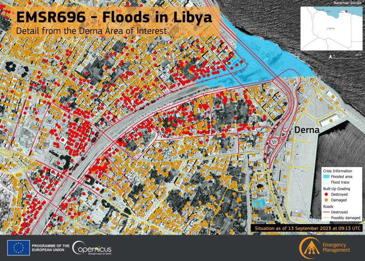
The European Union announced yesterday that its Copernicus satellite is producing maps that provide essential geospatial information to help rescue teams coordinate and support the people most affected by Flood Daniel in eastern Libya. This comes in support of the response to the catastrophic floods that struck Libya, it added.
The EU reminded that the floods in Libya affected not only Derna, but also many other cities. According to images obtained by the European Union’s Copernicus satellite, 4,454 buildings in Al Beida were also affected by the floods.
This effect is very clear when comparing photos taken of the city before and after Storm Daniel.
Conflicting news over ending of Search and Rescue for survivors in Derna (libyaherald.com)
UNSG Guterres calls for opening of investigations into collapse of Derna dams (libyaherald.com)
Derna update: International aid continues to arrive, infrastructure damage update (libyaherald.com)
Latest UN satellite imagery shows extent of Storm Daniel destruction in Derna (libyaherald.com)
More than 5,300 dead and 10,000 missing in Derna disaster (libyaherald.com)
More than 2,000 dead and thousands missing after Storm Daniel hit eastern Libya (libyaherald.com)
Libya hit by storm Daniel with eastern region suffering worse damage (libyaherald.com)


